May 31, 2018
Crossing the Gulf
In some ways things went as planned in others they went
awry. The original plan when was that we
would pick up our crew member, Joel, in Juneau and then quickly cross to Hoonah
near the exit of Icy Strait where we would meet our buddy boat Serenity. Before
we reached Juneau we were contacted by Serenity and alerted that they were
running behind schedule by a couple of days.
We asked Joel if he wanted to wait before meeting us and he indicated
that no, he would look at this as a chance to get oriented to the boat. With that in mind we took our time moving
west from Juneau with a side trip to Glacier Bay and then ending up in Elfin
Cove. We waited for Serenity in Elfin
Cove only to have them make the difficult decision that they weren’t
comfortable enough with the weather outlook to be sure that they could get back
to their jobs in time. We chose to go
ahead and head out.
 |
| Taku Harbor rocks (south of Juneau) |
 |
| Light and whales as we head out of Juneau |
 |
| Elfin Cove outer dock looking into town |
 |
| Salish Aire on Elfin Cove outer dock |
 |
| Elfin Cove General Store |
 |
| Channel into inner harbor |
 |
| Inner harbor Elfin Cove |
 |
| Elfin Cove US Post Office (and school when is now a museum) |
 |
| Jarvis walks on the Alaska State Highway in Elfin Cove |
 |
| Waterfall along the Highway |
 |
| The State of Alaska maintains the boardwalks through town |
We had basically two options: One option was to hop up the
coast taking advantage of various coves and anchorages but with the
disadvantage that the route would keep us in the rougher waters close to shore
and add about 7 hours of total running time.
The second option was to head in a virtual strait line (with slight
compensation to a Great Circle Route) to the entrance to Prince William Sound
(PWS). We initially looked and believed
we had 24 hours of really good weather so we headed for the village of Yakutat
about 22 hours northwest. On the way we
pulled updated weather charts that suggested less than perfect weather but very
doable for the next couple of days followed by very questionable weather
patterns. We made the decision that
“doable” weather was better than potentially a long stay in Yakutat and so
swung the wheel to port and a route directly to the entrance to PWS.
 |
| Our last look at SE Alaska (and any land for a while) Boat is an Alaska State Ferry |
 |
| Rivers of ice |
 |
| 9 PM on our first night crossing |
As a reminder: This was our first extended (overnight)
crossing. Our goal was to test our
abilities while we had Joel on board in case we needed to grab the third person
quickly. The first night was pretty uneventful with almost no wind waves and a
gentle 1 – 2 meter swell. With a half moon and only a couple of hours without
sunlight we never faced a time when we couldn’t make out the horizon. Clarice
and I slept fitfully as we tried to get into a routine but were very nervous
about this “BIG FIRST”. Joel, meanwhile got a very solid night of sleep which
was very helpful the next day when he was able to function at 100%. The next day the gentle swells turned into
corkscrew waves that are fairly uncomfortable.
Up to that point we had been using our hydraulic stabilizer fins only
(with the side poles out to help soften the role.) With the more uncomfortable seas we decided
to put our rarely used paravane stabilizers in the water in addition to the
hydraulic system. The difference was a dramatic improvement in how the boat
handled the conditions. We had expected
to lose up to 1 knot of speed with the paravanes but in reality the difference
was negligible.
The second night none of us slept as well as we would have
liked but we worked out a plan where 2 people would be in the pilot house so
that the third person could sleep soundly without worry that the person on
watch would have an emergency and not be heard. The second person could even be
asleep but they would be within shouting distance rather than in the more
isolated berth areas. It also helped
that about 1 AM we made landfall with Kayak Island off our Starboard rail. We had planned to do only a slight course
change to Starboard once we passed the island but instead chose to turn to a
course that within an hour had us in the lee of the island so the wave action
was much more comfortable.
Midmorning we approached the entry to PWS and called Valdez
Traffic Control on the radio. They
confirmed that they were aware of us from our AIS signal and indicated we
didn’t have any ships exiting the Gulf towards us – only a cruise ship
overtaking us to enter PWS before we would get there. Once in PWS the
difference was dramatic with much calmer waters and winds. The clouds started to lift and we were able
to get a small glimpse of the fabled cruising ground we had entered.
About 8:30 PM we were able to find a berth in Cordova small
boat harbor after 63 hours of straight running.
The bad news was the winds that we had hoped would run 10 – 17 knots
were more like 17 – 22 knots and the wave action was very uncomfortable at
times. The good news was that we
correctly predicted that the winds were always off our stern so we never faced
pounding into head seas. I (Norman) was
the only one to get sea sick enough to throw up once which had as much to do
with a lack of sleep as with not tolerating the motion. Bringing Joel was a
good thing – we could (would) have made the trip without him but having him to
spell us, and just knowing he was available decreased our stress
dramatically. We are sorry that Serenity
turned back but as their boat does not have both types of stabilizers they
would have had even a wilder trip than we did so we are convinced that for them
it was a good decision. Our fuel usage was right where we had anticipated at 3
nm/gallon and our speed was where we had hoped (7 + knots) rather than were we
planned (6 knots). In our final assessment Clarice and I agreed that the
experience reminded us once again of how solid of a ship Salish Aire is as she
never missed a single beat during the crossing with the big Lugger engine
chugging along and using no oil at all and the autopilot only needing attention
when we chose to make a course change.
We learned that this type of crossing in similar conditions is well
within our abilities as well. It was
good to get a good night’s sleep in a quiet harbor when it was all over.
Footnotes:
We wish to thank Joel profusely. He covered his own travel expenses and never
asked for anything from us other than the chance to join an adventure. He even put up with me being grouchy when I
was sleep deprived. Thank you Joel (and
Barbara for letting us borrow him for a week).
I also realized that about 2/3 of the way across the Gulf, I
quit referring to Salish Aire as a “boat” and started to mentally refer to her
as a ship. She has earned this
designation and I plan to continue to use it for her.
Cordova
Back in my nursing days in Everett I was very instrumental
in helping set up a very unique medical unit at the hospital. The unit was designed to care for medical
patients with behavioral issues. Many of
our patients came to us with severe infections related to their severe drug
addictions and others came with medical problems related to co-existing
psychological issues. To treat these
patients took some of the most dedicated RN’s and CNA’s I have ever
supervised. One of amazing CNA’s who
worked there was Debbie.
Debbie and Jerry’s stories are related in this article:
https://www.heraldnet.com/news/couple-shared-tragedy-loss-of-oso-but-found-love/
.
To summarize: Debbie was at work one
day and Jerry was out of town when a huge mudslide washed away their homes and
Debbie’s beloved husband and Jerry’s wife and son in a tragedy that few from
our part of the country will ever forget. Debbie and Jerry found love and
comfort in their shared experience and married each other and I knew they often
visited Jerry’s family cabin near Cordova. With some sleuthing on Facebook I
was able to find a phone number for Jerry and left him a voice message.
Debbie told me that they had only just
returned to the cabin a couple days before after being away for 2 years when
Jerry asked if she had any idea who the guy leaving the message was.
Since we have been here we have helped them a
bit at the cabin where their water line had slid down the hill and Debbie and I
were able to catch up on some memories of the wonderful work we did when we
worked together at the hospital.
Debbie and her husband took us in their truck to visit one of several local glaciers that are easy to access and then to the Copper River Delta. It was pretty amazing to see how a river that has never been diked, or dammed, or had its delta filled in for a town looks, especially one surrounded by untamed mountains and glaciers. We still have not seen any local bears (although Debbie and her husband always carry a firearm and we are back to carrying bear spray) but we did see a moose and 2 calves and many birds.
 |
| Sheridan Glacier near Cordova |
 |
| Sheridan Glacier lake and ice |
 |
| Clarice looks at the Sheridan Glacier lake |
 |
| Sheridan Glacier |
 |
| Clarice looks at the ice a few feet from her |
 |
| With Jerry and Debbie at Sheridan Glacier |
 |
| Clarice and Jarvis at Sheridan Glacier Lake |
 |
| Copper River |
 |
Swans on section of Copper River Delta uplifted during 1965 earthquake -
now turning from sand flats to marsh and forest |
June 3, 2018
Yesterday we left the noisy Cordova Marina to spend the
night in a quiet cove a couple of miles from town. The marina was exceptionally
noisy as small gillnet fishing boats were milling around revving their straight
pipe dual V8 engines as they waited for allotted times to run out to the
fishing grounds of the Copper River Delta and other places in PWS to try and
catch “their portion” of fabled salmon runs.
The problem was that the fish were not arriving on schedule (likely
because a cool spring has kept the rivers low as the glaciers and snow fields
have been slow to melt). So you have a
whole lot of folks whose very livelihoods are made or broken in a few short
months anxious and milling around and reminding me of the very salmon they were
waiting for as the salmon milled around at sea waiting for the rivers to rise.
Interesting to watch but between 1 AM dusk and 2 AM dawn we weren’t sleeping
well.
Two days ago there wasn’t a cloud in the sky and so we did
sunny day boat projects at the dock.
Clarice cleaned and polished and I dove below the keel to confirm there
was no damage from something big that we had run over while crossing the Gulf
(we suspect a log). There was no damage
so I cleaned a bit of marine growth from the engine cooler and replaced a small
zinc that had mysteriously disappeared
and declared the ship fit to continue on her/our journey.
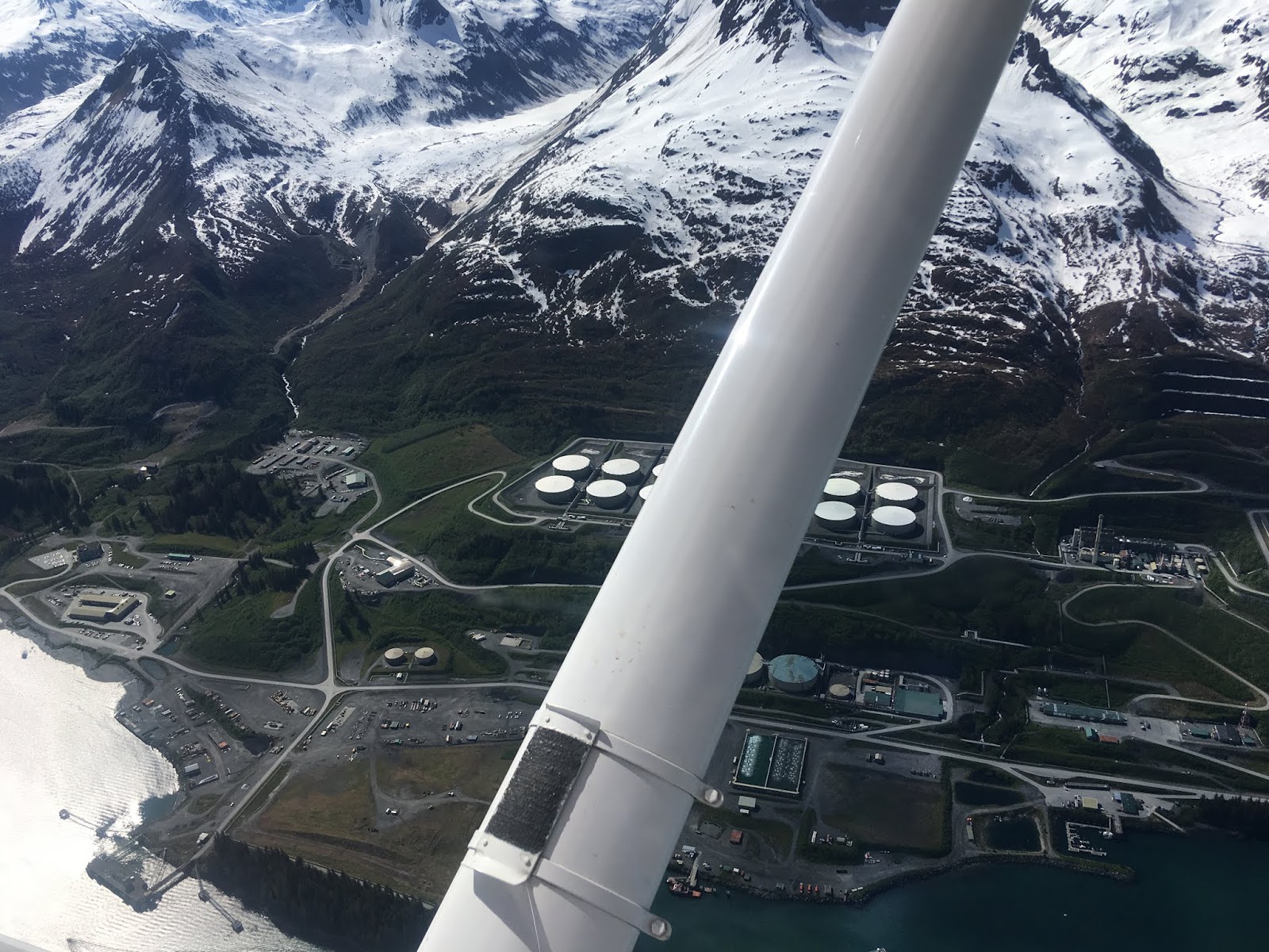
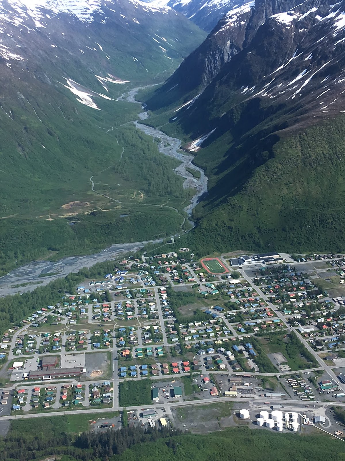
We are now on our way to really explore PWS planning to
visit a couple of coves on our way to Valdez at the southern end of the Alyaska
Pipeline with its northern terminal at the Arctic Ocean. It will be interesting as we followed the
pipeline from Fairbanks to Dead Horse deep in the arctic in 2000.
June 4, 2018
We spent the last two nights at anchor in the types of coves
that show up in cruising magazines and advertising brochures. It was oh so quiet and peaceful after the
noise of Cordova. We currently have a weak but stable high pressure area over
us so we have minimal winds but they aren’t strong enough to push all of the
clouds away although as I write this the sky is about 50% clear / 50% clouds.
We have yet to catch an elusive halibut or shrimp despite
hearing over and over that they are both so easy “you just need to put a hook /
trap in the water” – yeah right.
We did see our first really really big brown (grizzly) bear
yesterday after we had returned to the boat.
He was just ambling around the stream at the end of the cove (Jarvis and
I chose to avoid the stream this morning for our morning walk and to carry bear
spray – and have Clarice watching from
the boat with radio contact if she saw something – and Jarvis was back on his
leash with his bear bell).
We also watched an eagle swim to shore near the boat. Eagles will sometimes catch fish that are too
heavy to allow a water take-off so they hang on to the fish and paddle with
their wings. I’ve seen videos of this
before but it was pretty cool to watch in real life. When he reached shore he
had about a 12 inch flounder or halibut that quickly became dinner.
 |
| Hopefully the next bear will be closer for a better photo (but still far away for safety) |
 |
| St. Matthew's Bay |
 |
| St Matthew's Bay |
 |
| St Matthew's Bay |
 |
| St Matthew's Bay |
Life on Board:
Most of the time in the Salish Sea we anchored for a day or
so and then were back at a dock with an inexpensive electrical power connection
and water supply. Here even the marinas
may or may not have power and often the fees are quite high. With more and more time spent off grid we are
developing a pattern that seems to best use our on-board resources.
Electrical power: When we are off shore power and not
generating our own electricity we pull from two large deep cycle battery
banks. We have a forward bank with about
1200 amp hours of capacity and an aft bank with about 600 amp hours of
capacity. We charge them one (or all) of
3 ways: 1) we have solar panels on the roof of the pilot house. They have the disadvantage of not being
tilted toward the sun but are designed with micro grooves to pull some sun from
the off angles more efficiently. We have
been pleasantly surprised how well they work in these high latitudes and forgot
to consider that even late at night we are often making a few free watts as the
sky is light about 23 hours a day. With
a sunny day we can put off a generator run an additional day just with the
boost from the solar panels. 2) If we are running the main engine its 160 amp
alternator is able to push a lot of power back into the batteries depending on
the number of hours we are running. 3) We are finding that if we run our
generator for about 2 hours on a typical morning it will replace about 24 hours
of typical battery use and wash and dry a load of cloths.
Water: We have tankage for 260 gallons of fresh water which
last us at least 2 weeks of unlimited usage.
Most marinas have water on the dock and we always top off before we
leave. If we are in a clean anchorage
(minimal silt and/or oily scum) then we run the reverse osmosis (RO) watermaker
during our generator run which also helps with load control for the generator.
Heat: When we are underway we heat using heat from the main
engine as there is a heat exchanger in our hydronic heating system that
transfers the heat to the circulating water. At anchor we heat with the diesel
furnace during the day. At night we are
choosing to only heat our berth to save diesel and batteries (Jarvis and I both
have electric pads we sleep on as Clarice likes a really cool bedroom).
Fruits and Veggies: Clarice has figured out that apples,
oranges, sweet potatoes, cabbage, and potatoes hold up quite well in the
lazarette which is kept cool by being down in the seawater so she buys those items in bulk when we find a sale. For fresh greens we have been quite
successful growing a mini garden on the back deck which produces enough to make
fresh salads about twice a week (thanks to that 23 hours of daylight
again). Finally when we are in town we
pick up whatever else we need at the local grocery (and close our eyes as we
check out to not see the total costs).
 |
| The garden |
Milk: On one of the trips to Seattle we purchased a 50# bag
of powdered milk from a restaurant supply store. We have found that if we mix the milk with
water using a bar blender that the milk tastes very good. We also found a glass 2 qt bottle to store it
in – initially we used a plastic bottle but could not get it clean enough and
the milk soured early. Clarice has found
that if she buys Nido brand powdered milk that it has enough fat in it to allow
her to make her own yogurt.
Breads: Clarice has really gotten into making bread. We have everything from homemade bagels, to
sourdough, to English muffins, to breakfast scones with eggs, cheese and bacon
bits in them. Again, bringing a 50# bag of whole wheat flour north from the restaurant
supply in Seattle has saved a lot of money (and thanks to a lady at church who
gave us a good sourdough starter).
Sleep: Previous owners had installed blackout curtains on
the 3 skylights in the berth where we sleep – they are a necessity here as our
brains simply can’t get used to the hours of daylight.
Entertainment: We download a lot of books on our Kindles
when we are in port and usually there is a book exchange at most marinas where
we swap books. We also download movies
from Amazon and Netflix onto our iPad when we have internet service and then
watch them when we are ready.
Internet / phone: We have a phone plan with a LOT of GB of
data included. We have been surprised at
some of the places in the middle of nowhere where we get a good signal.
Jarvis: Jarvis has gotten a lot less fussy about using his
pad to pee on but we still have to take him out as he won’t ask unless he is in
misery. He doesn’t like it when water
comes up through the scupper onto the deck where his pad is usually located
during rough weather so we have to move it up to the protected Portuguese
Bridge when the going gets rough. He
DOES NOT like to poo on the pad so we have to watch him when he hasn’t been to
the beach in a while and if he pants and/or shivers, take him to his pad until
he produces. Otherwise he likes having a
captive audience to lie next to and just hangs out until we make landfall and
can take him to a beach.
Travel: One change I've noticed is that now that we have done our 3 day/2 night run in good and bad seas, distances seem shorter and we are much less bothered by rough water. It was good to get over that hump. We seem to be gaining more comfort with a travel style that allows for longer stays in port or at an anchorage if we want to see more rather than feel like we always need to keep moving.
All is well as we continue towards Valdez.


