August 28, 2018
Oh dear, I’ve gotten way behind in my notes so I’ll try to
do some speed writing to catch up. Let’s
see, our last notes indicated we were waiting for our son-in-law, Paul to join
us in Seward so we would have a third person for our first planned 3 day crossing. The plan was that as soon as we saw a good
weather window forecast after his arrival then we would head out across the
Gulf of Alaska. Initially we had planned
to head directly from Seward to Ketchikan where there is an airport served by
Alaska Airlines so we could get Paul
onto a plane back to his home in Ontario, Canada. We figured the distance would require
travelling 5 days straight before
landfall. Then we did some refiguring
and realized that if we made landfall in Sitka (to the north of Ketchikan) we
would make landfall in 3 days, get a good rest, get to see our friends in our
new “hometown” and still get to Ketchikan with only a few hours of extra travel
time.
Paul arrived in Anchorage at a bit past midnight and our
very good friend Bruce picked him up and let him catch a few winks on the couch
before taking him to the Alaska Railroad station for a ride to Seward. He reported that after he had napped for a
bit on the train that the scenery was pretty impressive along the spine of the
Kenai Peninsula. He arrived in Seward on
schedule at 11:05 AM and we fed him some fish and chips and gave him the news
that there would be no further rest for the wicked as we had a favorable
forecast and the boat was ready. So by 3
PM we had departed the western gulf heading back to Southeast Alaska.
 |
| Paul got a quick orientation to boat procedures including trying on his assigned immersion suit. |
A couple of geography notes:
- Initially I put a starting point on our electronic chart just outside of Resurrection Bay and an ending point just below Mt Edgecomb outside of Sitka and let the chart draw a line between the two (actually it drew a curve as at that latitude it doesn’t take much distance before a great circle route curve is shorter than a straight line). Remember back to the story shortly after we had arrived in Alaska where we were reminded of the importance of zooming in on a route before accepting it (recall a photo of a 75 ft yacht high on the rocks), I decided to follow my own “silly” rule and recheck the route in a closer zoom, even though it went through a very empty stretch of very deep water – well almost…. Middleton Island sits on the edge of the continental shelf about one-fourth of the way across the Gulf and low-and-behold our lubber line passed right through the island. After reading the fascinating history of the island as a NORAD radar station, I moved the line a bit south into deep water.
- As we were exiting Resurrection Bay I noted that if we hadn’t made a sharp turn to port we would have eventually come very close to the big island of Hawaii. Later that day I made contact with a ham radio operator in Maui and he asked why we hadn’t chosen to come visit to which I replied that without a full load of fuel we might will end up floating around the Great Pacific Garbage Patch. (Then there would be the matter of a daughter with a bit of a temper being told that her husband got to Hawaii without her.)
We did pull into Sitka harbor late afternoon 3 days later
after a pretty non-eventful trip. The
water wasn’t bad until about the final 24 hours when it got somewhat choppy
coming off the stern but the boat was fine and no sea-sickness on this run! We
were monitored along the way by fellow ham operators especially Darlene who
kind of a boater’s godmother to all ham operator / boaters in Alaska. When we arrived in Sitka it wasn’t long
before we were talking with another boater who on learning our names told us
that Darlene had given them the task of making sure we arrived safely.
During our time in Sitka we filled out our stores of
perishables and met up with as many friends as possible. We were able to visit St Peter’s by the Sea
and visit with our friends there before we headed out. Since Paul had expressed that he would rather
stay aboard than fly home from Sitka, we chose to anchor for a night at one of
our favorite places, Goddard Hot Springs.
 |
| Paul tries out an Alaska hot springs with us |
At this point I’ll add a side story about the equipment set
that caused us concern:
Radar fun
Salish Aire came to us with 2 radar
units, an older Raytheon (CRT screen era) likely original to the boat and a
state-of-the-art when it was installed Furuno that was added by the Goldbergs
in 2005. When we purchased the boat we assumed that the Raytheon radar was
likely at the end of its service life and had even gone as far as selecting a
successor to it. On the other hand it
worked well and the old CRT screen was very easy to read so we decided to hang
on to it until it failed. Furuno company is famous for their factory support of
even the older devices so we have planned to upgrade and repair that radar as
long as possible.
 |
| Ron Goldberg installing the main radar in 2006 when it was state-of-the-art Photo credit: Nancy Goldberg |
The biggest frustration with the
Furuno system was that while the chart-plotter/radar display screen functioned
as designed, the chart cards for it were becoming very difficult (and
expensive) to find even on the used market so when we learned that the next
grade version of the chart-plotter would plug directly into our current system
but could handle much wider area and much more available SD cards we set out to
find one. We did find a used one by
putting our need on the Nordhavn Owners Group list and figured that the savings
in chart card cost alone would pay for it in short order. When it arrived we realized that it probably
needed a new internal clock battery and that I needed to install the ARPA
(radar target tracking) board and video board from our old chart-plotter as it
didn’t have these extra capabilities.
After two tries (and a few unkind thoughts about the person who designed
the battery to be soldered in) all of the connections were happy and the new
chart-plotter/radar display booted up and actually demonstrated some really
nice upgraded software and graphics features we had not expected.
With the new chart-plotter/radar
display installed we headed for our first-ever 3 day continuous run across the
Gulf of Alaska. On the way we noted that
the Furuno radar was really only effective to about 7 miles. A bit of research indicated this was likely
due to an aging magnetron. But alas; We
had an extra magnetron on-board from another Nordhavn owner who had upgraded
his system and generously donated his “radar guts” to our spares supply. But no-joy: Apparently the spare was in worse
shape than the original. We did notice
that the old magnetron needed to be rebooted periodically which made us nervous
except for the happy knowledge that we always had the Raytheon as a backup
which was really important as we still had about 750 nm to go in notoriously
foggy waters before arriving back in Seattle. …..Then the Raytheon just quit –
burned a fuse (and the replacement fuse). Now it was time to be very concerned.
Happily as we headed to Ketchikan
we were able to contact a dealer in Petersburg who had a compatible magnetron
on his shelf. He put it in the mail and with only a partial day delay we were
able to install it and be on our way. It
is now clear to us that the magnetron has likely been failing since we’ve owned
the boat but since we usually operate in closed waters it had never been clear
to us that we had a problem. In the end we have a much nicer
chart-plotter/radar display and a fully functioning primary radar (and a new
Furuno mini radar waiting for us in Seattle to replace the Raytheon as our
backup system).
 |
| Fog ahead makes a radar a necessity |
Our run from Sitka to Ketchikan was otherwise uneventful and
once we saw Paul fly off and the radar repaired we continued our sprint
south. We reentered Canada in Prince Rupert
and then stopped at the villages of Hartley Bay and Klemtu and by August 1st
we were back in the protected water behind Vancouver Island.
 |
| In the Big House Klemtu village BC |
As we headed further south Clarice couldn’t understand why I
was getting irritable – she didn’t know that I was about to face a personal
demon. On our previous three trips up
and down Vancouver Island we had always taken the slower, safer route which
avoids Johnston Strait and Seymour Narrows.
For years I had read about the perils of this heavily travelled route
and, frankly, I had let the guidebooks freak me out.
Vipond, A. & Kelly W.; Best anchorages of the Inside Passage. 2006 P-194:
The steamships have been replaced by
cruise ships, but under the control of that great gatekeeper, Seymour
Narrows. Even the leviathan liners are
very careful about timeing their transit for slack water at this pass, with is
one of the most formidable on our coast with currents reaching 16 knots.
…”Everything hinges on Seymour Narros, It tells us how fast to go from Sitka all the way down the Inside Passage,” Captain
Ympa Ercka of a Holland America Line cruise ship confirmed. Asked about other hair-raising passes or
navigational hazards of the coast, Ercka shook his head: “There is only Seymour
Narrows. Nothing compares.”
Seymour Narrows is at the south end of Johnstone Strait
where if the tide is moving one way and the wind racing the other, waves can
rapidly build to challenging heights. The way for a small boat to traverse this
route is to carefully plan to ride the tide to Seymour Narrows and then pass
through them at slack. The evening
before our passage we worked our way south against the start of a northbound
tide and were quickly reminded of the power we would face as our speed over
water was maxing out at 9 knots but we were only making about 3.5 knots toward
the marina where we planned to spend the night.
We checked and rechecked the weather forecast to confirm that while the
winds were likely to pick up they should be off our stern and with the
tide. We calculated our travel times to
The Narrows several times until we were fairly satisfied we had a plan (then we
radioed a passing commercial tug and barge and rechecked with the experienced
captain).
Our goal was to reach The Narrows for an 11 AM slack tide
after riding the flood south as the waters where from Campbell River north come
from the north end of Vancouver Island.
We left our moorage at 4 AM as planned and immediately felt the current
add speed to our boat. The last of the
night and early dawn were beautiful and seeing the stars that had been lost for
several months in the Land of the Midnight Sun was a treat. The current increased and before we knew it
we were at the entrance to Seymour Narrows 2 hours ahead of schedule. Our backup plan was to sit in one of the
coves at to the north of the narrows should we arrive too early and we were
making plans to do so when we had the opportunity to watch a commercial fishing
boat with basically the same hull shape as us transit the narrows with little
trouble. So we went for it and watched
our over ground speed (we plan on about 7 knots) creep up to a record 13.5
knots. We passed over some upwelling
water and minor whirlpools but nothing as bad as we have experienced in the
past in other tidal rapids. Before we
knew it we watched Campbell River pass behind us. Just to add to the fun we slowed a bit as the
water coming from the south end of Vancouver Island started to ebb southward
and we were off again. By the end of the
day we had travelled 84 NM in record time and my personal sea monster was tamed
forever.
 |
Sunrise in Johnstone Strait |
 |
| Sunrise in Johnstone Strait |
We did follow our plan to haul out in Port Townsend. The boat was pressure washed and blocked by
noon on Friday and by that evening Clarice had the port side sanded and I had
the keel cooler drained and removed.
Saturday our brother-in-law Darrel came to help and the starboard side
was sanded and the first layer of paint applied while I cleaned the keel cooler
and started to separate the propeller shaft from the transmission. Sunday our longtime friend Grant came to help
and the second coat of paint was applied and Clarice and Grant reassembled the
keel cooler and put it back in place.
 |
| A dirty boat fresh from 2 years at sea |
 |
| Sanding a bit to help the paint adhere better |
 |
| Guard dog Jarvis atop his kennel making sure Darrell is safe |
 |
| Darrell and Clarice finish prepping the prop for |
 |
| Three cheers the paint is on |
 |
| Salish Aire returns to the sea with a pretty blue bottom |
We try to make sure that if there is a big project that
needs doing while the boat is out of the water that we plan it along with the
biannual bottom paint job. This year it
was replacing a rubber hose called a shaft log that provides a seal between the
hull and the packing gland that seals around the prop shaft. We had been warned that changing the shaft
log was not a huge job but getting the prop shaft loose from the transmission
so it could be changed was likely to be very difficult – it was. I think I took about 16 hours using every
trick I knew to break the shaft loose from the collar that mates it to the
transmission including using a breaker bar on a puller of sorts, a torch,
banging with a hammer, and more than a few choice words. The only position I could be in and work on
the project involved jamming my right foot next to the transmission and bending
my left leg over the top of the bilge area.
With my total lack of flexibility this led to cramps for days
afterwards. It wasn’t until Monday morning that the shaft came free and it only
took about another hour to change the hose and then one final hour to
reassemble the shaft to the transmission (with lots of Never Seize to hopefully
make it easier to take apart next time (hopefully when someone else owns the
boat)).
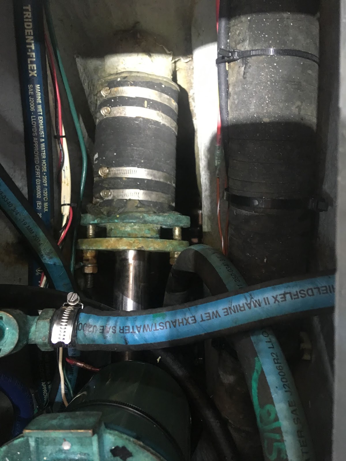 |
| The original shaft log hose to be removed |
 |
| These bolts were tightened to the max in order to get the collar (left side of the photo) to let go |
 |
| The new shaft log finally in place and ready for sea |
We finished our final small projects on Tuesday and were able to have the boat lowered back into the water early Wednesday a day ahead of schedule. We then headed to Oak Harbor marina, known for cheaper fuel prices, for the night and added 500 gallons of diesel the next morning. (We expect to get a warning letter from the coast guard as we had about one half gallon go out of our fuel vent into Puget Sound which is a big no no – frustrating as we are very careful when we fuel to avoid that mistake.)
After arriving back in Everett and retrieving Clarice’s
dad’s car we have been busy with provisioning, family get-togethers, doctor
visits, and final cleaning and prepping projects on the boat.
 |
| Gregory family picnic at Point Defiance in Tacoma |
One of our projects was to do our twice a year wet check of the bilge pump system. The system should work thusly: Step 1 the water is about 2 inches deep and the regular bilge pump activates and empties it. Step 2 the water reaches about 4 inches deep and a loud alarm sounds. Step 3 the water reaches about 10 inches deep (still only about 1/4 of the capacity of the deep bilge section) and a really big pump kicks in. The test went well except the alarm didn't sound because the tiny switch to silence it was in the "silence" position in the pilot house and had gone un-noticed. Had this been a real leak event that would have been a BIG problem. The solution was to take out the tiny, easily hit, switch and change it for a key switch so we think this problem will be much less likely to recur.
 |
| Now it takes a key to silence the bilge alarm |
We will be off to
Ontario to visit our daughter and her family in two days then when we return we
plan to take a day to add fresh veggies and if Neptune and the weather gods
agree we will be off for Mexico.
We are asked, "What was your favorite thing about Alaska?" Our favorite memories are 1) The beauty and people of Sitka. Wintering there was one of the best decisions we made. It truly became a second home to us. 2) and 3) The amazing scenery of Misty Fjords National Monument and Kenai Fjords National Park. Will we go back - a definite maybe but there is a lot of world yet to see.
With that we will leave some of our parting photos as we headed back to the Salish Sea.
 |
| We will miss our friends the sea otters |
 |
| Leaving Resurrection Bay |
 |
| Shear cliffs of Taz Basin on Granite Island |
 |
| Taz Basin |
 |
| Seal rookery in Taz Basin |
 |
| Sunset with forest fire smoke |
 |
| The only whale we observed breaching |