Tuesday, August 29, 2017
Eric's video
Thanks to Eric B for this video of the time we spent with he and Michelle in the Octopus Islands
Into the Mist (and Rain)
8/26/17
Clarice ended our last note with us crossing Dixon Entrance
and re-entering the USA (Alaska) with fair seas and fairly nice weather. Since we could see that our weather window
was not likely to last more than a day we went ahead and went the full way into
Ketchikan rather than making an intermediate stop as we had planned.
In 2000 when we started into the channel leading to
Ketchikan we were greeted by a pod of Orca fishing and swimming directly off
our bow. This time it was a pod of
humpback whales using a fishing technique where they swim in a circle and all
jump half way out of the water at once.
I didn’t expect the jump and so got only the end of it on video (but I’m
finally finding some less camera shy whales).
They put on a show for us for some time.
The past two nights we stayed at the Ketchikan Yacht Club
docks. I was excited to see the actual
bell that is rung at the end of the R2AK race in the club house when we joined
the group for burger night. We have seen
a couple of the boats that were in the race this year along the way but haven’t
met any of the owners yet. We did make a
note-to-selves that we really need to emphasize when we call in for dock
assignments that we are a BIG 46 ft boat.
This time we barely squeezed into the spot they had arranged for us but
they have a flat $35/night rate including power which is a great deal for us.
On the maintenance side; Ketchikan is the first dock we have
stayed in that were equipped with GFCI breakers on the dock electrical
posts. This revealed that somewhere on
Salish Aire we have a fault that I haven’t found yet. At first I thought it was an inverter issue
but I’ve pretty much ruled that out. I
did find that one of our outlets had the neutral and hot wires reversed (3
years of ownership and I’d never checked all of the outlets with my handy dandy
outlet checker – embarrassed). Another
outlet had corroded connections. Bottom
line is that I need to start working my way through the 120 V wiring and
looking for (and correcting) issues as I find them.
Ketchikan is showing signs that they are likely to blow
their all-time rain record out of the water. Just saying that our new rain gear
purchased in Prince Rupert (with Canadian dollars J ) are getting well
tested. We giggled at the cruise ship
passengers with their freebie ponchos that didn’t look like they were much help
at all. We were amazed to see four ships
in town at once with a steady parade as soon as one left another arrived.
 |
Entering Ketchikan |
For many years I have been fascinated by the idea of
circumnavigating Revillagigedo Island.
Now that we have time and fuel to do so we are going for it. We left this morning in low clouds and rain
heading for an anchorage in Misty Fiords National Monument.
8/28/17
Last night the rain stopped and we anchored in a truly
idyllic setting in a very protected cove behind an island. The island has a forest service cabin on it
where two middle age guys were just setting up housekeeping after being dropped
off with their kayaks by a guide service.
We kayaked over and visited with them for a bit and checked out the
cabin – a very cozy and critter proof place in an incredible setting. It comes with bunks for 4, a wood stove
(wood), a deck with a bench, an outdoor fire circle, and a priceless view and
solitude.
 |
| FS Cabin |
 |
| Anchorage from cabin deck |
 |
| A proper outhouse |
 |
| Campfire circle |
We kayaked around the bay and walked Jarvis on the shore
(where he almost got a bit too curious about a small porcupine!)
Today we took a side trip up Rudyerd Bay which is rated as
one of the prettiest in Misty Fiords NM.
All we can say is “WOW” and thanks to the folks who worked to preserve
this place. I’m hoping that of the many, many photos I’ve been taking today
that some of them will show the majesty of the place. Think of Yosemite in a fiord instead of a
valley with the only tourists being those who fly or boat in. (We’ve only seen
one other boat today exiting the bay and a number of float planes that either
do fly-throughs or fly-in and land on the water for 20 minutes before departing
back to Ketchikan.) We have had a dry
day with broken clouds and glass smooth water.
A truly awesome experience.


 |
| Porthole view of our world |
 |
| New Eddystone Rock (the remains of a volcanic intrusion) |


8/29/17
It looks like we will have internet access before the day so
I will try to catch up on notes. After
we left Rudyerd Bay another cruising boat contacted us on the VHF radio and recommended
the mooring buoy in Walker Bay (which we had planned to skip) – MV Pleasant if
you read this – Thank you, Thank you for the recommendation. Again we travelled through a fiord that
challenged Yosemite for spectacular scenery.
The buoy was in the end of the bay next to a small creek
outlet. It still seems unsettling to us
to be so close to shore and then realize that the depth sounder at the buoy
shows 50 feet of water under the keel.
We had never caught a mooring ball with this boat before and were a bit
concerned about how to accomplish the task without a crew member falling
overboard. We figured out years ago that
it is much easier to catch the ball from the aft section of the boat and often
shake our heads watching people hanging off the bow trying to reach the mooring
below them. Instead we take a long line
from the bow back to where the boat has a low gunnel and then threat the line
through the loop on the ball and take it back to the bow and tie it off. Salish Aire doesn’t have any really low spots
for reaching over except through the side doors. The plan was that I would try to stop the
60,000 lb boat dead in the water a foot from the buoy within the space of an 18
inch doorway. I came close enough on the
first try that Clarice was able to get the line through the loop. (We have now done this twice and are feeling
pretty sure of ourselves – guaranteeing that the next time will be a total
foul-up.)
We did have a bit of cloud cover that night so the stars
were occluded but that was a pretty minor complaint when you consider we had
this amazing place entirely to ourselves.
The next morning we could see blue sky above us but fog all around the
boat as the morning mist rose from the water. We took the camera in the kayaks
and got some pretty cool photos as the morning fog moved around the basin. We kayaked up the creek a ways and saw a few
spawned-out salmon barely alive or dead in the water.


I had hoped that Bell Island Hot Springs Resort would have
been resurrected as it is reported to be under new ownership. Alas it is in terrible shape with the only
new construction being “no trespassing” signs.
So we moved on to Bailey Bay and spent our second night on a FS mooring
ball (Thank you Forest Service!!). We
walked a short distance up a trail that was supposed to lead to a lake and a
hot springs but decided we were ill prepared as the trail got rougher wearing
our rubber boat boots and not carrying any emergency supplies when we were in a
very remote location so we turned back about ½ mile in. We then kayaked around the bay before heading
back to the boat for dinner. The only
negative thing was Jarvis decided he needed to disguise his scent by rubbing in
some poo he found on the path – this is a new behavior for him and one we hope
he doesn’t repeat.
Last night I woke up about 2 AM and walked out on deck to a
display of stars such I have not seen since my youth when there was less light
pollution. WOW!
Today we will return to heading north once we exit Behm
Canal. We have been told that anyone who gets one day of good weather in this
area is really lucky – we have had three very nice days with anywhere from
scattered clouds to clear skies. I only
wish I had a chance to take a float plane trip over the Misty Fiords NM as I
expect that the views would be very different and very spectacular.
I think we are both beginning to emotionally accept that we
really aren’t on a schedule and can stop when we want or move on when we
want. I think we will try to get on to
Sitka within the next few days so we can at least figure out if we will stay
the winter there or if we need to look at other options.
Clarice's notes:
August 26, 2017
Last night the Ketchikan Yacht Club ( who’s docks were have
been moored at for the last couple days) offered a hamburger dinner for a
donation. We like to support the yacht clubs if we can as they usually offer
very affordable rates. There is no reciprocal moorage available at the
Ketchikan Yacht Club..you are requested to fly your burgee and if you fail to
pay, they will charge your yacht club the fees you’ve incurred. Not quite how
it usually works, but since they were pretty inexpensive so be it. Our slip was
interesting in that Norman managed to squeeze us in a very tight slip. I had
told the moorage coordinator the size of our boat, but as he was assisting with
tying the boat up upon arrival his comment was “ Wow, that’s a really big
boat”. My thought is “and that’s why I told you multiple times our size and
requested clarification if there was a slip that was adequate for us. The
awesome pilot that Norman is made it all work and we were quite snug in our
temporary quarters.
After a couple of very rainy days in Ketchikan we opted to
explore Misty Fjords National Monument and escape what even the locals thought
were extremely rainy days ( the bus driver told us 10 inches of rain in two
days). We headed out in a mild breeze that gradually built to 14 or so knots.
The crossing over the end of Revilligegedo Island was a little sloppy ( I videoed the slop but not sure if it really
explains what it is to those of you who are not boaters) but we finally put out
the paravanes and that calmed it out nicely. The breeze finally came off our
stern and so we chugged happily along viewing lush emerald green forests that
come right down to the sea.
I put out my salmon fishing rig and must have had something
on it, however the line was old and snapped. Lost all the rigging on it (bummer)
but found some replacements in my sorry pile of fishing gear so will try it out
tomorrow. I guess I’m a glutton for punishment, but would love some Salmon or
Halibut. Tried the halibut rig but not really deep enough where we are anchored
tonight.
We entered the bay we were going to anchor in and managed to
fit over the 8 ft ( more like 7 feet in reality) shallow spot that was part way
into the entry and anchored just off the USFS bouy and near the USFS cabin.
Shortly after we got the boat secured two men in kayaks headed over to the USFS
cabin. We launched our kayaks and headed over to the beach. I chatted with the
men while Norman and Jarvis explored the area. The men graciously allowed us to
check out the cabin. It is quite new and very lovely…and what a lovely setting.
We could use the buoy however we are usually reluctant to
use them due to our boats weight ( she’s a svelte 60000 pounds). We kayaked by
the buoy and it’s extremely stout and looks very secure. Since many of the
anchorages are quite deep and not the best seabed to set an anchor, we may try
one out. We discussed how we would hook the buoy since we’ve not been able to
use one with this boat before. It might be a bit of a challenge but it would be
great to try it out.
We headed back to the boat eventually for dinner and our
evening down time. I took a shower and took a picture to share of my view from
the shower. I opened the port as it’s not raining and quite warm outside.
Pretty awesome to have this wonderful view while you shower.
Sounds like the weather will be a little better for a few
days so we are excited to explore the fjords and see what they have to offer.
Thursday, August 24, 2017
Leaving Prince Rupert
August 24,2017
Oh happy Day we are on our way…again. After 5 days exploring
all the wonders of Prince Rupert and having buckets of rain wash our deck as
clean as can be, we are ready to continue northward.
We did enjoy the museum in PR – small but packed with so
much information and items to see. Had some really nice long walks which is
always a bonus when cruising. I found a fabric store that is just opening so
added a couple of pieces of fabric for my “ Far North Quilt” that I’ll work on
this winter.
We’ve met some other Nordhavn owners…some with more experience,
some with less but we all have something to share.
Evidently we are not the only ones enjoying a somewhat sunny
and very calm Dixon Inlet transit. We are in the company of many recreational
and work boats.
It’s been interesting adapting to the “not having to go to
work” plan. I’ve had time to do some projects that needed to be attended to on
the boat, I’m enjoying having time to cook meals that take more than 30
minutes( I do find the crock pot is great when we are underway – it’s nice to
know dinner is pretty much done when you are done with your day of travel), baking bread…oh yum. Cannot get into that
habit too much but it’s sure fun for the moment. I’ve done a lot of reading,
but decided I’ve got to do something else besides vegetate.
So grateful to have a partner that is so adept at figuring
out issues when they crop up and then willing to instruct me in what’s
happening and how to troubleshoot. If anything is stressful, the not knowing
how to fix something is it…I’m learning but I want to know it all now!!!
The scenery today is absolutely beautiful..many islands and
interestingly sharp peaks in the distance.
Talked to a very friendly customs officer
when dealing with how to check in in Ketchikan…I’ve not conversed with such a
pleasant person in that department ever. Unfortunately she was losing me
reception wise so will try to call back later if we cannot make it to Ketchikan
today ( a very long run for our slow boat).
I love looking out to my left and seeing the ocean and
dreaming of what may be “over there”. Don’t know if our dreams will pan out in
the long run but they are certainly alive at this point.
I’ve been able to contact my Dad and he’s doing pretty OK
overall. I had an off day on August 17th after dreaming of Mom all
night before. Then realized it’s been 2 mos. since she passed. Had a tearful
morning but that too passed. We’ve been able to contact kids and Norman’s Mom
so that’s all good.
We rigged the paravanes in anticipation of a sloppy
crossing, but it’s not messy.
Soooo. we decided to deploy the “fish”
and let the system work. The swell from the ocean is calmer with the paravanes
deployed however we have to remember to
not let the logs get caught by the lines.
Norman purchased a fishing license for me so we’ll see if I
catch enough to make it worth it. I think I’ve got all the tackle I need, just
need to see what will attach to the end of that line.
I’m not a writer by nature, but decided I will try to
participate in the blog a little more to give a little different flavor to it.
Clarice
 |
| Big House at New Bella Bella |
 |
| Lots of waterfalls through the mist and rain |
 |
| Butedale almost abandoned cannery |
 |
| In Prince Rupert felt small with a Nordhavn 78 on one side and a 96 on the other (but a 40 finally came in and we felt better) |
Thursday, August 17, 2017
North of Queen Charlotte Sound
8-16-17
At one time I believed Alert Bay was just a Canadian Coast
Guard Radio outpost as we heard them calling the further north we
travelled. When we came up this way in
2000 we learned that Alert Bay has a very large First Nations presence and an
outstanding cultural center. I really
wanted to stop in again to visit the cultural center and it was as good as I
recall (but no photos of the displays are allowed and it is the Potlach Room
full of historic dance masks that awakens something deep in my soul).
 |
| First Clarice made a fancy breakfast |
 |
| Alert Bay Marina |
 |
| Anglican Church Alert Bay |
This time the Coast Guard Station has been reduced to an
automatic repeater station for Victoria Coast Guard and we ended up at a grill
owned by an Indian (NOT First Nations) family who served me really great
halibut and chips and Clarice a tandoori chicken dish native to India.
Sunday morning Clarice served a very fancy breakfast then we
attended the Anglican Church in town before walking to the cultural center.
The next night we spent in Hardy Bay where we double checked
the weather for the morning and all looked good for an early departure to cross
Queen Charlotte Sound which is one of the two places we have no choice but to
be exposed to the Pacific Ocean on this route north.
 |
| Sunrise leaving Port Hardy |
 |
| Sun rises above the low clouds (Canadian CG ship) |
 |
| Lots of little islets as we head out Queen Charlotte Strait |
 |
| Rounding Cape Caution |
 |
| Jarvis hunkered down by his heat outlet while we are on less than smooth water |
We had a very nice crossing of Queen Charlotte Sound with
about 1 meter swells and about 5 kn winds usually off our stern. During the crossing we had porpoises in our
bow wake for a bit which was very entertaining to watch. Overall it made for a long day but there was
lots to see along the way. Our current sea mammal viewings include a humpback
whale, a very large sea otter (that we thought was a log and almost ran over),
lots of seals and sea lions, and periodically porpoises at a distance and now
up-close.
In many ways this is our first long distance shakedown
cruise after doing 3 years of upgrades and learning about the boat. In the last
update I noted that I had finally buckled down and was trying to understand all
of the nuances of our 12 v system and the measuring gauges that came with the
boat. My timing was serendipitous as I had
just learned that I did have a way to watch the amperage output of the main
engine alternator. I had been just using voltage changes as an indication that
it was working correctly which really indicates a problem after it has been
going on for some time. Several times in
the past few days we have noticed the alternator output drop to very low or
zero. The first time it happened I
confirmed that no connectors had fallen loose, belts were tight, and other
usual alternator trouble shooting. We
shut down the engine and restarted and had good power output so we figured that
something had been loose. The next time
it happened I learned that if I disconnected then reconnected the external
voltage regulator that it would reboot and we would have power again for a
while but this strongly hinted that the external voltage regulator was the
source of the problem.
Batteries on boats are one of those topics that can lead to
long strings of absolutely correct opinions that all disagree in some way in
boating interest groups. In summary; it
is generally agreed that flooded batteries, such as we have, should be charged
in 3 stages. Stage one (the “bulk”
phase) is to get a lot of power back into the cells quickly and runs at about
14 volts. Stage two (the “absorption”
phase) is at a lower voltage and “tops off” the cells. Finally Stage three (the “float” stage)
maintains the voltage during light use and/or storage. Fancy regulators are designed to maintain
the batteries for the longest service life possible by running them through a
very carefully prescribed charging process.
Many boats are equipped with external regulators that direct the
charging process and are considered by many as superior to the internal
regulators that are used on alternators in cars and trucks throughout the
world. Since we carry a matching brand
new spare alternator which came with an internal regulator it seemed a good
plan to either swap out the regulator or the entire alternator. Swapping the brushes and the internal
regulator from the new alternator was a pretty minor process compared to
swapping the entire alternator so I decided to give it a try. As we have carefully planned, but never had
to put into practice before, Clarice started the wing engine (which started on
the first revolution after all of our work on it!) and then shut down the main
engine while communicating with me via a Bluetooth headset that I have adapted
from my motorcycle helmet to fit in hearing protectors. The swap went smoothly and the alternator
immediately started producing power and continues to do so today. Now the question remains is there a
correction that I can make to the old external regulator or has it reached the
end of its service life. Also will the new regulator work “just fine” or is it
really worth the trouble to go back to an external device.
 |
| Installing a new alternator regulator underway |
I also spend the morning yesterday while we were at anchor
moving a bunch of connections in the pilot house and in the front battery bank
area so that the gauges themselves are wired to better function with the
changes that have been made since they were installed a number of years
ago. We now have good and reliable data
on the alternator performance, status of the main engine starting battery and
the forward house battery bank. I still
need to move some heavy wiring in the aft bank (which we tend to use as our
backup bank) before I will have good data but at least I now understand the
changes that need to be made.
After crossing Queen Charlotte Sound we anchored in Pruth
Bay around the corner from the Hakai Beach Institute. Not only is Pruth Bay a very protected and
lovely place to anchor the folks at Hakai welcome visitors with a dingy dock,
limited internet access, and boardwalk trails to several of the prettiest
beaches we have encountered north of the Oregon Coast. The difference between the beaches on Calvert
Island and the Oregon beaches being that the crescent white sand beaches with
picturesque rocks and islets off shore are places of solitude rather than covered
with hordes of tourists. The grounds of
the Hakai Institute are also lovely with natural vegetation mixed with floral
gardens.
 |
| West Beach Calvert Island |
 |
| Clarice on West beach Calvert Island |
 |
| Happy Jarvis 1 |
 |
| Happy Jarvis 2 |
 |
| White sand and rock on West Beach Calvert Island |
 |
| Nature's sculpture |
 |
| Shallow lake along the trail from West Beach to North Beach |
 |
| North Beach |
 |
| Selfie on North Beach |
 |
| Clarice pulling the crab pot |
We ended up staying two nights and taking Jarvis to the
beaches a couple of times where we walked and enjoyed the scenery while he ran
around being a picture of pure, unadulterated doggy joy. Clarice was even able to stock the
refrigerator with some crab meat for a future meal.
Today we are heading north towards the almost ghost city of
Ocean Falls.
Jarvis and Clarice playing on the beach video
Jarvis and Clarice playing on the beach video
8/17/17
On arrival in Ocean Falls we quickly pulled down a ceiling panel as we had a small drip when it rained. Turns out that a bolt holding the radar base was leaking. We did a quick seal job and made a note that in the future we need to pull the whole base and re-seal the whole thing as one bolt leaking is suggestive that time has taken its toll and the other 7 bolts will drip before long.


We left Ocean Falls early this morning. I have always had an interest in wilderness
towns that have lost their reason to exist and are going back to nature. Ocean Falls was created to support a paper
mill which was built as the source of the paper’s raw material. Forest were plentiful and power was cheap
once a dam was built at the head of a falls near the apex of an inlet. Several
huge concrete buildings were put in place for the mill itself and workers
housing. Initially the paper company
decided they could no longer make a profit and so stated its intention to
leave. British Columbia bought the mill
and tried to keep the workers employed but the mill could not make it even as a
non-profit and so it was abandoned.
 |
| Approaching Ocean Falls - The tall concrete building is long abandoned |
 |
| The dam designed to power a paper mill and town now needs to make only a fraction of its design electricty |
 |
| The lake above the dam |
At this time the dam still exists and makes power for Ocean
Falls and two other towns. A marina is
maintained by the small cadre of full and part time residents for themselves
and visiting boats. There are just
enough folks living on –site to justify a BC ferry run a couple of times a week
with a tiny ferry boat. A company that
raises Atlantic salmon smolt for the
fish farm industry has taken over the old paper mill and provides a bit of
employment. Most of the original town is
falling into ruins accelerated by the huge annual rainfall. I enjoyed walking
about but was ready to leave this morning as we need to get north a ways if we
are to make the weather window we hope will open next Sunday for Dixon Inlet.
We have arrived in Klemtu First Nations Village after a bumpy ride through Milbanke Sound with winds gusting to 24 knots. Our route from Ocean Falls took us through Gunboat Passage with some really nice scenery. Exiting Milbanke Sound we encountered fog in Fitz Hugh Sound where we had some pleasant radio chats with a BC ferry and a small freight boat to make sure everyone knew what everyone else was doing with about 1/2 mile visibility. AIS ("see and be seen" for boats) is really nice when visibility is limited. It doesn't replace radar but it certainly adds to it. From the fog we moved into lower winds (gusting to 14 knots) and its raining very hard so its nice to hunker down in our warm boat. Clarice made soup and toasted crab and cheese sandwiches to warm us up after a walk into town.
We have arrived in Klemtu First Nations Village after a bumpy ride through Milbanke Sound with winds gusting to 24 knots. Our route from Ocean Falls took us through Gunboat Passage with some really nice scenery. Exiting Milbanke Sound we encountered fog in Fitz Hugh Sound where we had some pleasant radio chats with a BC ferry and a small freight boat to make sure everyone knew what everyone else was doing with about 1/2 mile visibility. AIS ("see and be seen" for boats) is really nice when visibility is limited. It doesn't replace radar but it certainly adds to it. From the fog we moved into lower winds (gusting to 14 knots) and its raining very hard so its nice to hunker down in our warm boat. Clarice made soup and toasted crab and cheese sandwiches to warm us up after a walk into town.
 |
| Eagles adorning the entrance marker to Gunboat Channel |
 |
| A tug and two barges headed to Seattle |
Saturday, August 12, 2017
Salish Aire has left the Salish Sea
8/10/17
By definition the Salish Sea includes the inland waters of
Washington and British Columbia that are primarily connected to the Pacific
Ocean tidal circulation via the Strait of Juan de Fuca. We have now travelled north of that general
boundary and the currents and tides of the waters we float on communicate with
the Pacific Ocean via Queen Charlotte Strait.
Salish Aire was named to carry the legacy of her home port wherever she
travels and now she has officially started on that journey. While we were walking around Sidney BC we
poked our heads into the local aquarium and found a great book explaining the
Salish Sea which we bought to show folks we meet during our travels about this
fascinating area.
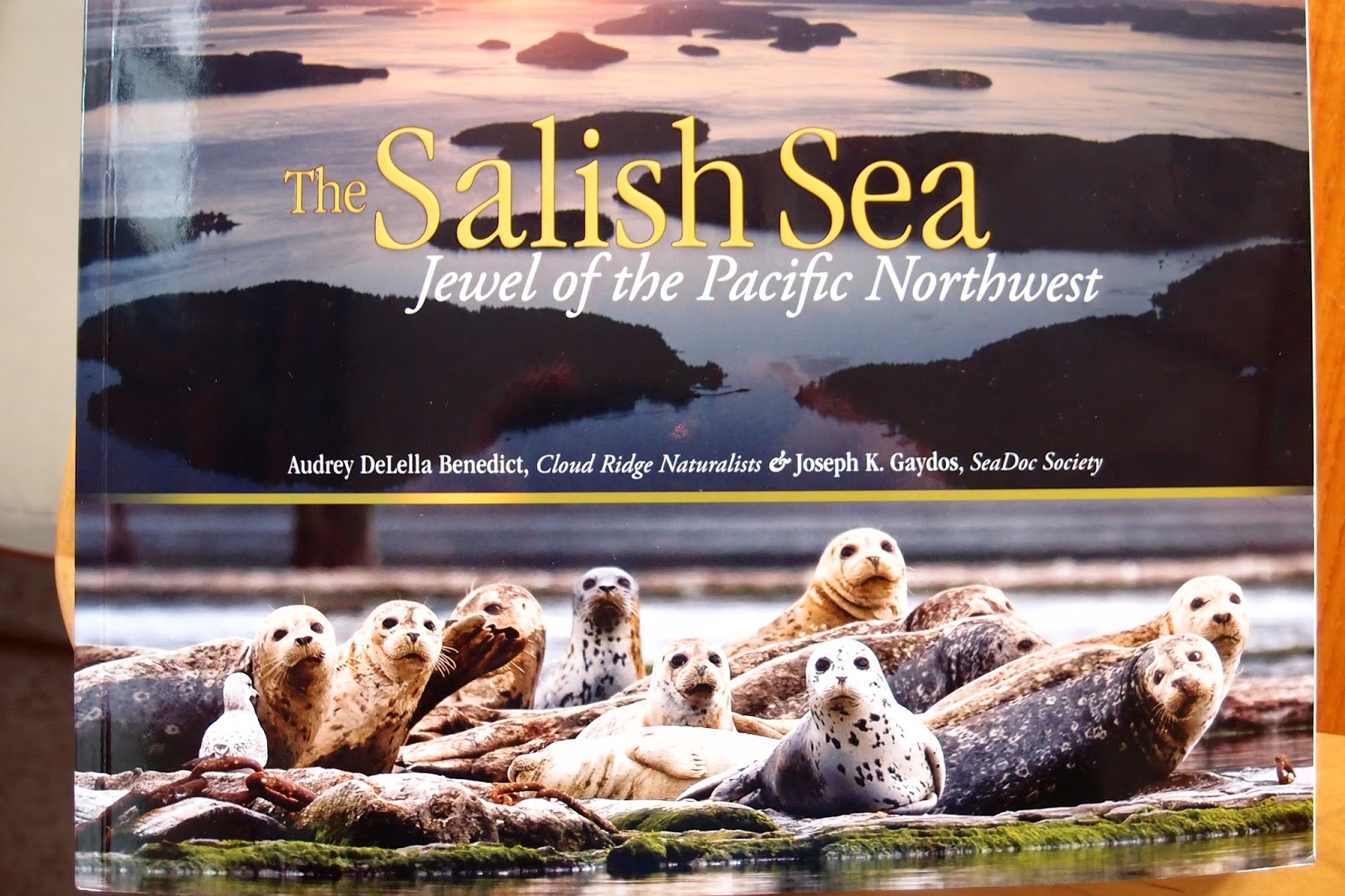 |
| A great book telling the story of the Salish Sea |
 |
| Map of the Salish Sea |
We have heard many many questions about our specific plans
for our travels. We are purposefully
keeping those plans to a minimum. In
doing our book learning in preparation for this journey one message has been
repeated over and over by experienced cruisers which is that over-planning and
over-scheduling is the fastest way known to get yourself into trouble. Experienced cruisers study the weather
carefully and let nature determine when they will leave port rather than
letting a date on the calendar make those choices. In our case, we have a lot to learn about
handling the boat and our own capabilities.
We know that the boat will cross an ocean but we doubt our own readiness
at this point.
The plans we have made are to head north to SE Alaska with
the plan of staying over in a port (likely Sitka) for the winter. We had hoped
to meet up with friends from Everett as they headed south from their summer
expedition to Glacier bay and we were able to meet them 2 days ago in the
Octopus Islands where we are currently anchored. We had also planned to move fairly quickly
north until we were north of the common “Desolation Sound” cruising area which
has its northern psychological boundary about where we are now. From here north we have only visited once
before in 2000 and have looked forward to taking time to enjoy at a slower
pace.
Likely one of the big reasons that the boats from the Salish
Sea tend to start thinning out from here north is that the tidal challenges
become significant. One of the
challenges of boating in this part of the world is learning to live with
nature’s tidal exchanges which in some areas create rapids that have put many a
boat on the rocks through the ages. Now
we have the advantage of very carefully studied and calculated tidal guide
books that tell us when the twice daily rise and fall of the tides changes
direction and thus creates windows when the waters in the narrow spots are
quiet and safe to transit. We have spent our entire boating careers living with
these facts of Salish Sea boating life so while we find the challenges to be
inconvenient at times we just follow the rules set by the sun and the moon and
recognize that a big part of the diversity of life in these waters only exists
because of the mixing of waters providing the nutrients to drive a complex food
chain. Boaters from around the world
tend to think highly of boaters from this part of the world because of our
comfort with the moving waters and even local boaters shy away from the fastest
rapids which leads to less crowded boating the further north we travel.
 |
| Tug and log boom working the tidal currents |
So far we have transited tidal rapids in Deception Pass
Washington, Dodd Narrows BC just south of Nanaimo, and Surge Narrows so that we
could get to our present location in the Octopus Islands. After having a
wonderful day yesterday visiting with our friends and Kayaking and Hiking to a
mid-island lake we plan to leave today when nature says it is OK. Today we plan to move north and east so we
can go the “back route” and avoid Seymour Narrows but in order to do so we have
to travel through a number of
challenging tidal rapid areas. Our first
encounter will be with the rapids at both ends of Hole in the Wall channel and
then we will turn north toward the Yaculta rapids group. So far it looks like we will need to wait the
six hours between slack times in order to make it to our planned anchorage for
tonight as the timing of slack waters doesn’t allow for travel from one narrows
to the next at our speed.
 |
| Eric and Michelle on Secret Beach headed south after a summer going up the Inside Passage |
 |
| A hazy sunrise thanks to forest fire smoke |
 |
| Octopus Islands Anchorage |
 |
| Heading out of the Octopus Islands |
8/12/17
We are currently in Johnstone Strait which can be a really
nasty piece of water if the tide is against the wind or a very pleasant place
to travel as it is this morning. We were
able to get through the final 3 tidal rapids yesterday after managing to creep
through the Yaculta group at 3.5 knots over ground (while doing about 9 knots
over the moving water) just after slack but before the full fury of the rapids
had built the day before. All of this moving water has meant that our expected
3 nm / gallon of fuel has instead been just over 1 nm / gallon as it seems that
we keep moving up current – until today when we are finally in-sync with the
tide as it ebbs north instead of south during the first half of the day. We are
currently moving at 8 kn over ground and 6.9 kn over water so nature is giving
us a “free” extra mile every hour. We
started the day on mirror smooth water but in thick fog. As we have moved from
the side channels into Johnstone Strait proper the fog lifted a bit so we didn’t
have to be totally dependent on radar an AIS (location information broadcast by
some, but not all boats). As we have
moved north the fog bank has kept ahead of us so we have had good visibility
most of the day.
Speaking of visibility, we seem to finally have moved north
of the smoke from the BC forest fires.
Last night Jarvis decided he needed to visit his pee-poop pad at 2 AM
but it did mean that I was awake to see the moon and the stars for the first
time without a haze of smoke.
 |
| In the heavy fog we could see our own bow and not much more |
 |
| Both radar units and the AIS transmissions from other boats become our "eyes" and we listen carefully for horns or engine noise |
 | |
The fog begins to lift just a bit |
 |
| Finally able to see ships visibly we had been watching electronically |
 |
| Chasing fog up Johnstone Strait |
 |
| Fog off the bow but clear looking south down Johnstone Strait |
Folks often ask if we are tied up every night or anchored –
the answer is we do both. As we are
trying to learn to live on a much more limited budget we are taking advantage
of low cost opportunities to be at docks when they are available as it makes it
much easier to get to shore otherwise we anchor out which has the advantage of
(usually) being very peaceful and private.
Low cost dock opportunities so far have included using yacht club
reciprocal moorage (usually about $5/night for power), using public /
commercial wharfs (about $40 USD / night in Comox), and a complimentary night
as we chose to use the unmaintained outer dock at Morgan’s Resort (which was
only a couple of hundred yards from the VERY expensive docks at Dent Resort
(reported to be $4/ft so about $200/night for a boat our size and with the
expectation that you get dinner at $125/plate!)
The weather has cooperated being in the upper 70’s during
the days and just cool enough at night for Clarice to sleep well with the
overhead hatch open.
 |
| Our very inexpensive moorage looking at the transoms of Dent Resort |
Entertainment consists of watching the scenery, walking on
trails through the forests (which lets Jarvis’ inner Jack Russell come out as
he runs full speed up the trail to find the next “nose candy” and then sniffs
for a bit before taking off again), swimming in a lake, checking out a harbor’s
nooks and crannies in either the dingy or paddling in kayaks, reading books, watching the British TV series “Last
Tango in Halifax”, catching up on business and pleasure email when we have
cellular service, and doing boat maintenance.
Boat maintenance ranges from the basics of checking the engine room
periodically for any signs of trouble to rebuilding another section of the
pilot house panels, to learning how our electrical gauge system is designed to
work (and how I need to change it so it works with the current battery and
solar configuration). All in all Clarice
and I keep fairly busy between driving the boat (which can be anything from
very intensive in a high current area or high traffic area to really boring
when the auto-pilot is keeping us on course without much human help required
and all stages in between).
 |
| Making blackberry cheesecakes for desert |
 |
| Drying laundry |
 |
| New facings for the radar and SSB radio - Old gray Formica under the chart plotter |
 |
| Next area to be refaced with holes from retired gauges (ladder, plug and key chain to the left get hung in front of chart plotter as reminders that our ladder is in the water and shore power connected.) |
So far we have happened into a festival and fireworks show
in Comox, met up with our good friends Eric and Michelle as they headed south
from Alaska, had a quick radio conversation with some Nordhavn friends as they
headed south through Dent Rapids and we headed north, had a pleasant visit with
some other Nordhavn friends while we waited at Shoal Bay Resort for the slack
to occur for our next rapids transit, in addition to people we just meet on the
way who have a common interest in boats and nature. We have heard over and over from long term
cruisers that you are never out of touch with friends for too long as you will
often run into someone you know at the next port. We are certainly finding this to be true.
 |
| Our friend David passed us in Mary Pearl just as we were about to go to press |
As far as adapting goes, we are now 1 week into official
retirement. To say that we haven’t felt
a bit of stress would be untruthful. A
couple of days ago Clarice and I found ourselves grouching with each other over
things that normally we just let go. We
took a minute and reflected on all of the changes and stressors over the past
month as we had the kids visiting, and were finalizing employment, and mail,
and insurance, etc. issues on top of moving to a whole new lifestyle and agreed
that while being grouchy was not fun it was to be expected.
I hope to post this today as we plan to stay in port at
Alert Bay where I have really nice memories of a First Nations museum from our
last visit in 2000. We had planned to spend time in the Broughton Islands but
it looks like we have a nice weather window for crossing Queen Charlotte Sound
if we keep moving north so our plans have been adjusted accordingly.
Subscribe to:
Posts (Atom)