9/2/17
It seems like a big deal to me to finally see and set foot
on Baranof Island. First we have never seen it before. When we came up this way in 2000 we stays to
the east and travelled up to Juneau and then Skagway. On this trip we are moving to the west to get
to our planned new base of Sitka.
Yesterday we saw the island for the first time and were impressed – this
is not a hilly little island but rather has glaciated mountains not far from
the shore! We arrived at Baranof Warm
Springs after a long day of travel with the final couple of hours being through
rough waters. But I get ahead of myself!
In our last entry we were still in great weather in the
northern arm of Behm Canal. After that
the weather started to deteriorate and we have had lots of rain and wind up
until today. We got bumped about a bit in 25 kn winds until we worked our way
into Meyer’s Chuck. Meyer’s Chuck is a very protected group of coves with a
small community tied together with trails and boardwalks. In 2000 when we were there I wondered if it
was on the decline as the trail to the (fairly new) school was overgrown and we
never did see any local residents. The
good news is that the community has been spruced up and even has a very nice
new community dock. It looked like most
of the seasonal residents had left but there were a few hardy souls still
in-chuck and I suspect they live there year round.
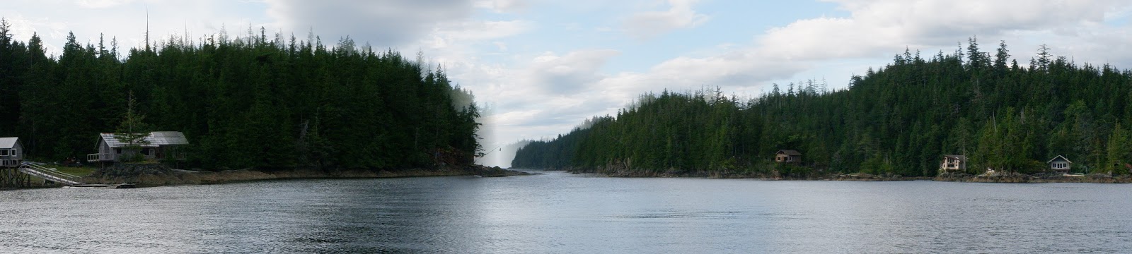
 |
| Meyer's Chuck |
 |
| Meyer's Chuck panorama |
From Meyer’s Chuck we travelled north through Zimovia Strait
to Wrangell where we continued to get rained on. We spent a night in the marina
and then headed out in rain and wind the next morning to head north through
Wrangell Narrows.
At the north end of Wrangell Narrows is the very
Scandinavian town of Petersburg. We have
been to Petersburg twice, once in 2000 and then again in 2015 for the Nordhavn
Rendezvous. Since we have been giving a
lot of consideration to staying in Petersburg both based on our experiences and
the blog of Sweet T, a Nordhavn 40, who spent last winter there. Our conversations with the harbormaster
confirmed that they could accommodate us with reasonable rates and good
electrical connections. While we have
decided to move on to Sitka for now, their very welcoming approach may well
bring us back in the future.
 |
| Petersburg |
 |
| Petersburg 2 |
While we were in Petersburg we were able to confirm that we
have a place to moor in Sitka and so we headed out into gray skies continuing
to the west. We spent a long day on the water and pulled into the warm springs
cove just before dusk. The cove is again
one of those places that represents the attraction of SE Alaska. At the head of the cove is a huge waterfall
with hundreds of salmon teaming at the bottom waiting for a chance to climb
it. The cabins in the cove are connected
by a boardwalk that goes along the foreshore. On the boardwalk is a bath house
with three tubs with warm springs water plumbed in for visitors to use. We used the tubs with light provided by our
kerosene lamp until we were warm to the core. When we were walking back to the
boat the moon poked out from behind a cloud suggesting better weather for the
morning. We awoke this morning to clear
blue skies with light winds. A couple of
black bears were checking out the stuff on the shore at the base of the
falls. After walking the dog and taking
a lot of photos we headed north for the next leg of our journey to Sitka which
is 20 miles due west or 90 miles by water so it will probably take us two days
to get there via Peril Strait.
 |
| Our first look at Baranof Island |
 |
| Baranof Bear |
 |
| Waterfall and cabins Baranof Warm Springs |
 |
| Bear checks out the breakfast options along the shore Baranof Warm Springs |
 |
| One of three natural spring fed hot tubs available to the public |
 |
| View from the public tubs |
 |
| Hot tub house along the boardwalk |
 |
| Very new dock (a bit of a challenge to land the boat due to the very strong current from the falls) |
 |
| Last look at our bear friend |
 |
| Leaving Baranof Warm Springs to travel around the N end of the island to Sitka (only 20 miles away over those mountains) |
Boat stuff (after passing the 1000 nm mark): The boat continues to run well getting about
3 nm / gallon of diesel. We have only
used the generator twice – once to run the watermaker and once when we had
issues with the main engine alternator regulator. We have confirmed (and even have support from
experts via the Nordhavn users group) that we can run using our build in
regulator if need be without problem although we switched back to the external
regulator yesterday after making some minor changes and it seems to be working
reliably again. We now have good data in
our fancy electricity monitoring system and are learning how to understand it
better which is leading to greater comfort with our energy budgeting
strategies. One thing that has helped a
lot was learning to adjust our two inverter/battery chargers so that they draw
a much more limited amount of power when we are plugged into low amperage shore
connections. At the suggestion of a Nordhavn 40 owner we talked to who also has
both hydraulic and passive stabilizers we have tried using the two systems
together and are finding them very synergistic in dampening rough motion. We have now started lowering our outrigger
poles daily (as we note that most of the local fishing boats do) before we
leave a protected harbor since being on the top deck in rough water is
uncomfortable. We keep the paravane “fish” attached and find that we can easily
launch them in rough conditions since we only need to go into the protected
cockpit. We will need to figure out our longstanding issue with a leak in the
upper 1/8th of our large fresh water tank once we get settled in
port and create a “permanent” seal for the base of the main radar. This is in
addition to normal maintenance stuff after 1000+ nm.. We have been very pleased
with most of our decisions such as buying the aluminum hull dingy, buying tough
hulled kayaks, going to a newer inverter/charger, etc.. We are still learning
to use our HF radio as we now get our weather forecast and some email over it
on a regular basis when we are out of cellular range although we still have not
been able to demonstrate the phone service connection we subscribe to. When we were hiking in a cove after having
only seen one boat for the day and knowing that no terrestrial radio signals
were getting anywhere, I was glad that we have our satellite text option for emergencies. All and all our planning and preparations
have served us well thus far as has Salish Aire herself.
9/4/17
We anchored for one night between Baranof Warm Springs and
Sitka in lovely weather. Yesterday we arrived about 11 AM and then took Jarvis
on a walk after we figured out which slip is “ours”. We turned around after walking to St Michael’s
by the Sea Episcopal Church where we were able to meet the local priest and her
husband and some of the parishioners as they were finishing up their after
service social time. By evening the rain
had started to return.
 |
| Peril Strait anchorage |
This morning it is raining and raining – there is no forest
fire concern here as all of the normal rain that usually heads to BC and Washington
this time of year is being steered north by the jet stream. So while they
complain of hazy skies and too hot record temperatures with records numbers of
days without rain we wade about when we walk with the dog or to the grocery
store.
 |
| View from last of passage to Sitka |
 |
| Entering Sitka |
 |
| Wet rain gear collection from morning walks |
 |
| Our slip for the next few weeks at Fisherman's Quay |


No comments:
Post a Comment